Tiedosto:Quebec-map.png
Tarkempaa kuvaa ei ole saatavilla.
Quebec-map.png (280 × 230 kuvapistettä, 15 KiB, MIME-tyyppi: image/png)

|
Tästä tiedostosta on saatavilla myös SVG-versio eli vektorigrafiikkatiedosto. SVG-versiota tulisi suosia, mikäli se on laadultaan tätä rasterikuvaa parempi.
File:Quebec-map.png → File:Québec, Canada.svg
|
 |
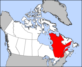
Map of Quebec (Canada)
Projection: Lambert azimuthal equal-area
Geospatial data from: The Atlas of Canada, The National Atlas of the United States and U.S. Geological Survey
Cartographer: John Fowler
| Minä, tämän teoksen tekijänoikeudellinen omistaja, julkaisen tämän teoksen public domainiin eli luovun kaikista tekijänoikeuksista lain sallimissa puitteissa. Tämä on voimassa maailmanlaajuisesti. Joissain maissa laki ei mahdollista tätä. Mikäli näin on: Myönnän kenelle tahansa oikeuden käyttää tätä teosta mihin tahansa tarkoitukseen, ilman mitään ehtoja, ellei laki vaadi ehtojen asettamista. |
Tiedoston historia
Päiväystä napsauttamalla näet, millainen tiedosto oli kyseisellä hetkellä.
| Päiväys | Pienoiskuva | Koko | Käyttäjä | Kommentti | |
|---|---|---|---|---|---|
| nykyinen | 24. maaliskuuta 2005 kello 15.18 | | 280 × 230 (15 KiB) | Voyager | Map of Québec Projection: Lambert azimuthal equal-area Geospatial data from: [http://atlas.gc.ca/ The Atlas of Canada], [http://www.nationalatlas.gov/ The National Atlas of the United States] and [http://www.usgs.gov U.S. Geological Survey] Cartograph |
Tiedoston käyttö
Tätä tiedostoa ei käytetä millään sivulla.
Tiedoston järjestelmänlaajuinen käyttö
Seuraavat muut wikit käyttävät tätä tiedostoa:
- Käyttö kohteessa en.wikinews.org
- Liberal minority government elected in Quebec
- Overcrowded Montreal hospital asks public to stay away
- Accused killer of Canadian police officer released on bail
- Gilles Duceppe drops out of Parti Québécois leadership race
- 14 people injured after bus overturns in heavy rain near Quebec City
- Quebec man found not guilty in shooting death of Laval officer
- Käyttö kohteessa en.wiktionary.org
- Käyttö kohteessa es.wikipedia.org
- Käyttö kohteessa fr.wikinews.org
- Käyttö kohteessa he.wikivoyage.org
- Käyttö kohteessa pl.wikivoyage.org
- Käyttö kohteessa su.wikipedia.org
- Käyttö kohteessa sv.wikivoyage.org
- Käyttö kohteessa test2.wikipedia.org
- Käyttö kohteessa uk.wikivoyage.org
- Käyttö kohteessa www.wikidata.org